
A striking Chilean flamingo with grey legs and pink leg joints wades through water in Los Flamencos National Reserve. Credit: Indy Burke
Yale Alumni Academy Trip to Chile, Land of Contrasts
January 19 - February 2, 2023
A striking Chilean flamingo with grey legs and pink leg joints wades through water in Los Flamencos National Reserve. Credit: Indy Burke
January 19 - February 2, 2023
Dean Indy Burke’s description of a two-week trip with the Yale Alumni Academy in Chile, including remarkable opportunities to learn more about Chile’s climate and environment, observe the effects of climate change firsthand , and engage with a wonderful group of alumni and oh yes, great and plentiful food and wine!
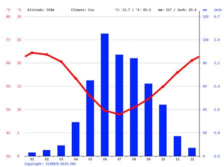
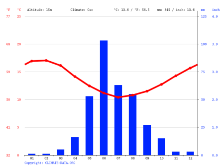
I will begin each section with some climate data, to show not only the weather we experienced, but also the high variability that exists in Chile and along our route which took us down to from northern to southern Chile. This first one shows the structure quite well: the red line is average monthly temperature, and the blue bars show average precipitation in the month. They are scaled to show periods of water “excess.” When the blue bars are above the red line, the water is available for aquifers, plant use, and human use. In contrast, in during periods of water “deficit” the evaporative demand of the atmosphere is so strong that most of the water is evaporated.
Santiago: What to notice here is that we were there in the dry season, which is warm (averaging mean daily temperatures of 68 — the daily maximum was closer to high 80’s and even low 90’s), and we never saw a cloud. It is 33.5 degrees south latitude. You can see that January is on average the driest and one of the warmest months. The country is experiencing a “megadrought,” meaning the water deficit is much higher than what’s depicted in the bar graph above. .
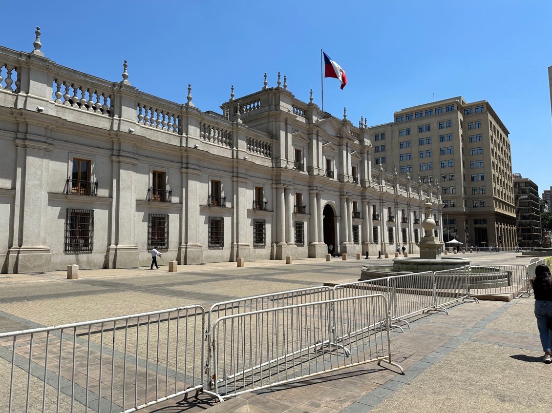
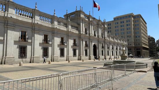
Today, we met Alicia, our awesome guide who was with us the whole trip. (Thank you to URI through the Yale Community Carbon Fund for the opportunity to offset the trip though travel miles!) She took us on a tour of Santiago that included several of the city’s most well-known historic and government buildings. Alicia told us a great deal of the oldest history of Santiago, then the brutal rule of dictator Augusto Pinochet (1973-1990), the succession by Patricio Aylwin, up to the recent protests and efforts to rewrite the Chilean constitution. We saw many of the historic sites, some by walking, and others we drove by, including Cerro San Cristóbal, Palacio de la Meda, and Basilica de La Merced.
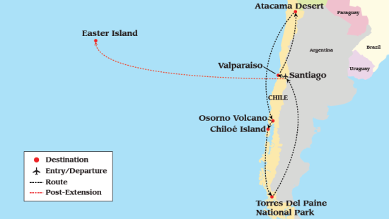
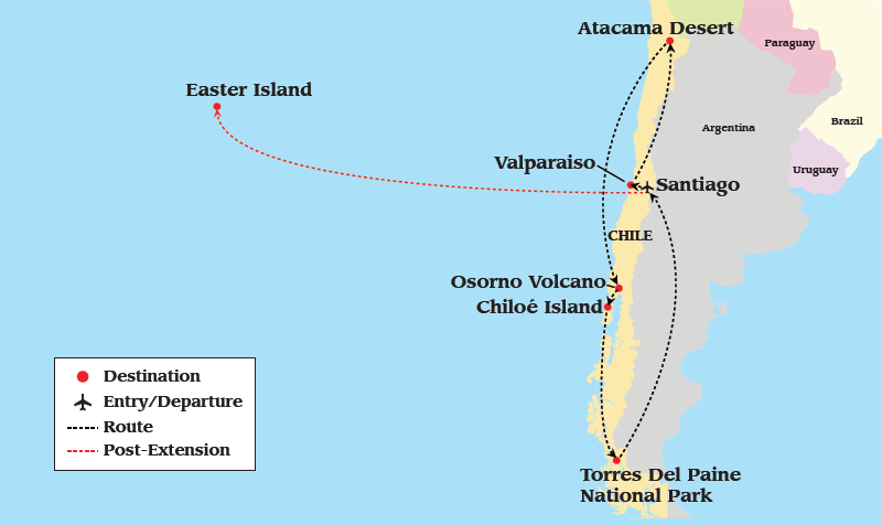
Map of the tour route

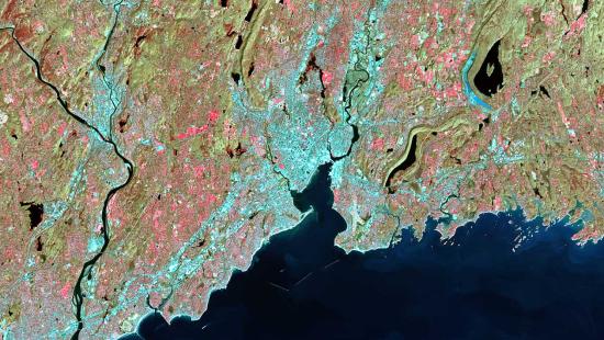
Satellite Image of Chile’s terrain
This evening, we have our first lecture from Dr. Bill Lauenroth, who spoke about the climate in Chile and its vulnerability to the effects of climate change. Here is a summary of both of his lectures — this one that he gave on the first day and one later in the trip.
Synopsis of Lectures from Professor Lauenroth
Chile is the longest country in the world stretching from latitude 17.5 S to 55.5 S approximately 2750 miles — the distance between Ketchikan, Alaska, to the southern tip of Baja California. Because of the arc of the country and bays and inlets, the Chilean coastline is even longer. From a climate and ecosystem perspective, the north is dominated by hot, dry deserts; the center by wet cool winters and hot dry summers; the south by wet cool grading into moderately dry cold in the far south.
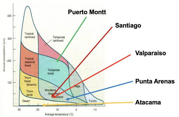
Our trip will take us from the Atacama Desert in the north to the grasslands, shrublands, and woodlands around Santiago and Valparaiso, to the productive native forests and plantations of Eucalyptis of Monterey Pine near Puerto Montt, and finally to the Patagonian Steppe around Puenta Arenas in the far south. This typical precipitation / average temperature / ecosystem type map locates our stops.
Similar to many other countries, Chile is experiencing negative effects of climate change. The clearest signal is the high temperatures and continuous drought the country has been suffering under for the past 12 years with no respite in sight. In fact, most climate models predict no end in sight for the drought.
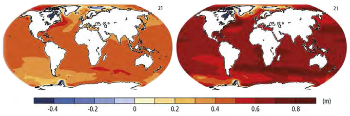
Chile’s long coastline makes it vulnerable to sea level rise, which was a quarter of a meter (10 inches) in 2005 and is predicted to reach a half a meter (20 inches) by the end of this century.
The next day, we drove west for an hour or two to the historic port of Valparaiso, which used to be, before the Panama Canal, the most important port in South America. It is a World Heritage site (UNESCO). It was first populated by the Pinunche natives, and was established by the Spanish in 1536. We saw some historic sites, had a view of the port and the beaches, and walked through the historic old town with beautifully painted houses, and the well-known murals of the city. We rode a gondola-like elevator down to sea level.
We then drove back toward Santiago, and stopped for a delicious lunch at Viña Matetic, in Cartagena, Chile. We had a tour of the vineyard from a wonderful host (Jostin), learned about the history of families who started this vineyard and those nearby (many of whom were Croation), and had an elegant wine tasting of Chardonnay, Sauvignon Blanc, and Syrah — all wonderful. Jostin told us that they found that they could grow the Syrah on the “warmer north facing slopes” — that turned our heads around for a bit, until we remembered that we were south of the equator!
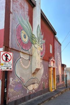
One of the interesting murals in Valparaiso
Exterior of the Palacio de los Tribunales de Justicia (Supreme Court of Chile) in Santiago
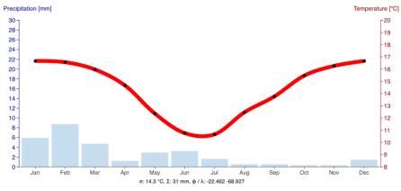
We flew north to Calama, Chile, 24.5 degrees south latitude, and 7,400 feet in elevation, then drove north to San Pedro de Atacama (23 degrees south latitude, 7900 feet elevation). Note on the diagram below that TOTAL annual precipitation is about 31 mm or 1.2 inches per year on average— less than a tenth of Santiago (sorry about the slight change in format; there aren’t climate diagrams for Calama that convert to English units). While we were there, during the “wet season,” that means in all of January, the average is 6 mm, or 0.24 inches. Furthermore, the entire year is in water deficit.
We flew over the Atacama desert and could see the light blue of the salt lagoons, as well as the lithium and copper mines. Chile produces more copper than anywhere else in the world, and the world’s biggest copper mine is quite close to Calama in the Atacama.
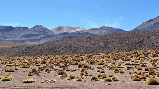
We checked into a sweet little hotel in San Pedro, east of Calama, at an elevation of 7897 ft and were told to be very careful about our water use (see climate diagram above). We met our guides, Andrés and Andrea. After a short break, we met for an afternoon tour and took a short hike in the desert, viewing volcanoes in the distance, large expanses of newer ash (last several decades?), with essentially no plants at all. On the locations with older ash, we were happy to find some old friends in the plants, ones we had seen in Patagonian Chile, and some new, and learn about the medicinal uses by the indigenous communities.
I read before we went that the Atacama is often compared to Mars, because of the harsh living conditions. A recent paper claimed that the conditions are so similar to Mars that it is hypothesized that there may have been similar bacteria.
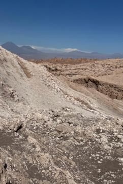
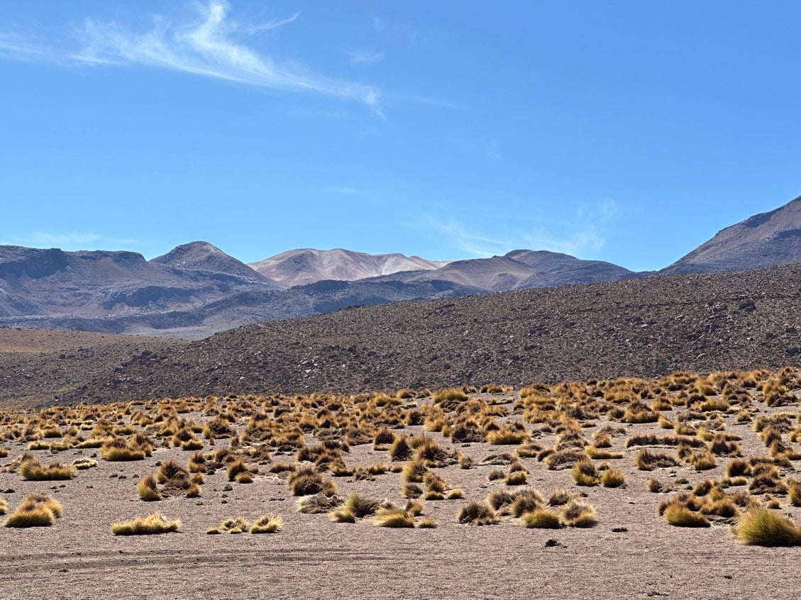
A view of the desert, with very few if any plants, due to low precipitation
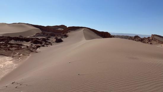
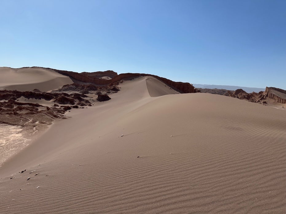
Sand dunes of the Atacama
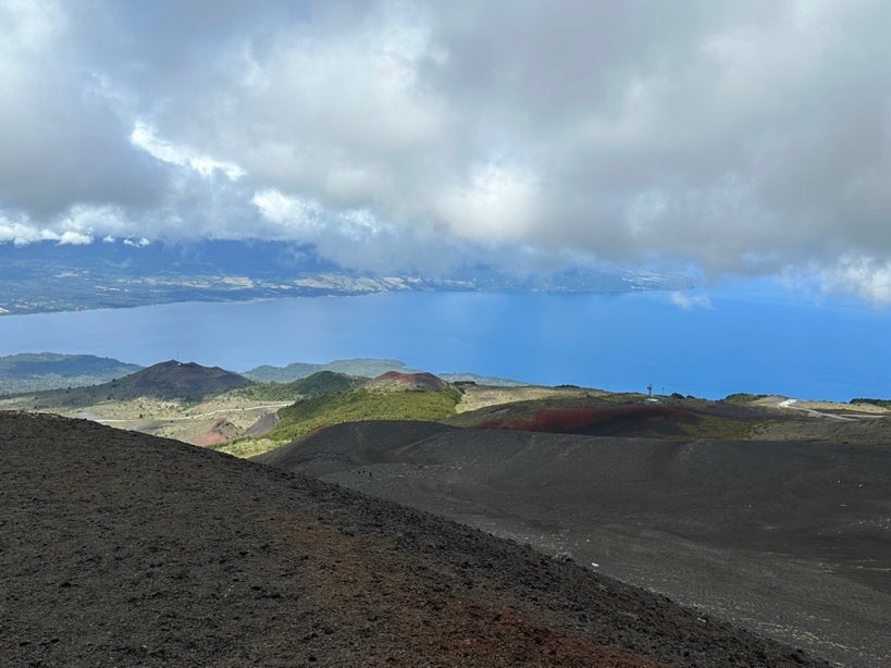
We are told to arise very early and to be prepared for high elevation, as we are due to go from San Pedro to the Tatio Geysers, 89 km away. The drive is a long one and on some pretty wash-boarding roads. We pass some incredible scenery and wildlife, but we wanted to get to the geysers during their peak activity. We were not disappointed!
As we were quite high — both literally and figuratively: the web says 16,800 feet elevation, though Bill’s fancy watch said closer to 14,000 feet (still HIGH and our heads were quite light!). There was a bit more moisture (still VERY dry), and we saw some old friends in the plants.The hot springs were full of organisms called thermophiles, likely examples of some of the earliest forms of life on the planet.
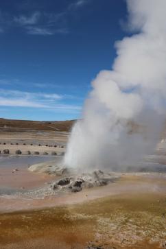
An active geyser
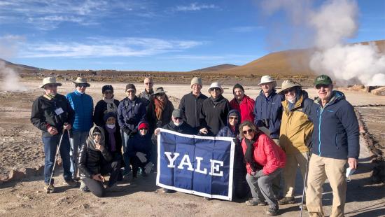
The full group
Festuca gracillima or coirón
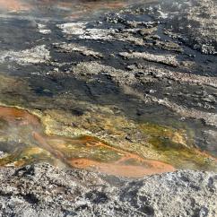
Thermophiles in the hot springs
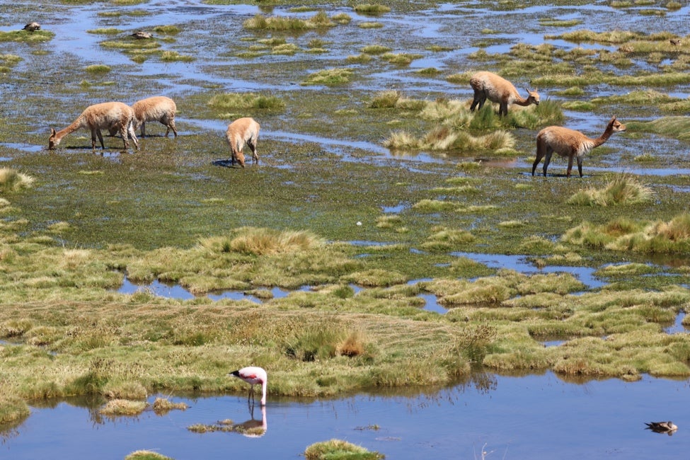
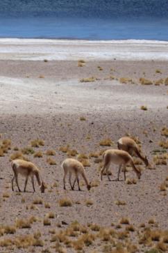
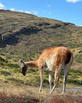
On the drive back to San Pedro for lunch, we saw flamingoes, other water birds, and our first camelids, the vicuñas. We stopped briefly and were assured by our guides that we would have time to see more of these creatures in the coming days, but this photo (below, left) turned out to be one of my best photos of the vicuñas!
Vicuñas and an Andean flamingo
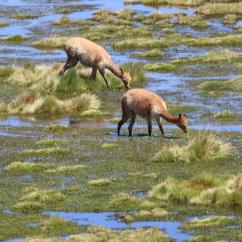
Vicuñas grazing
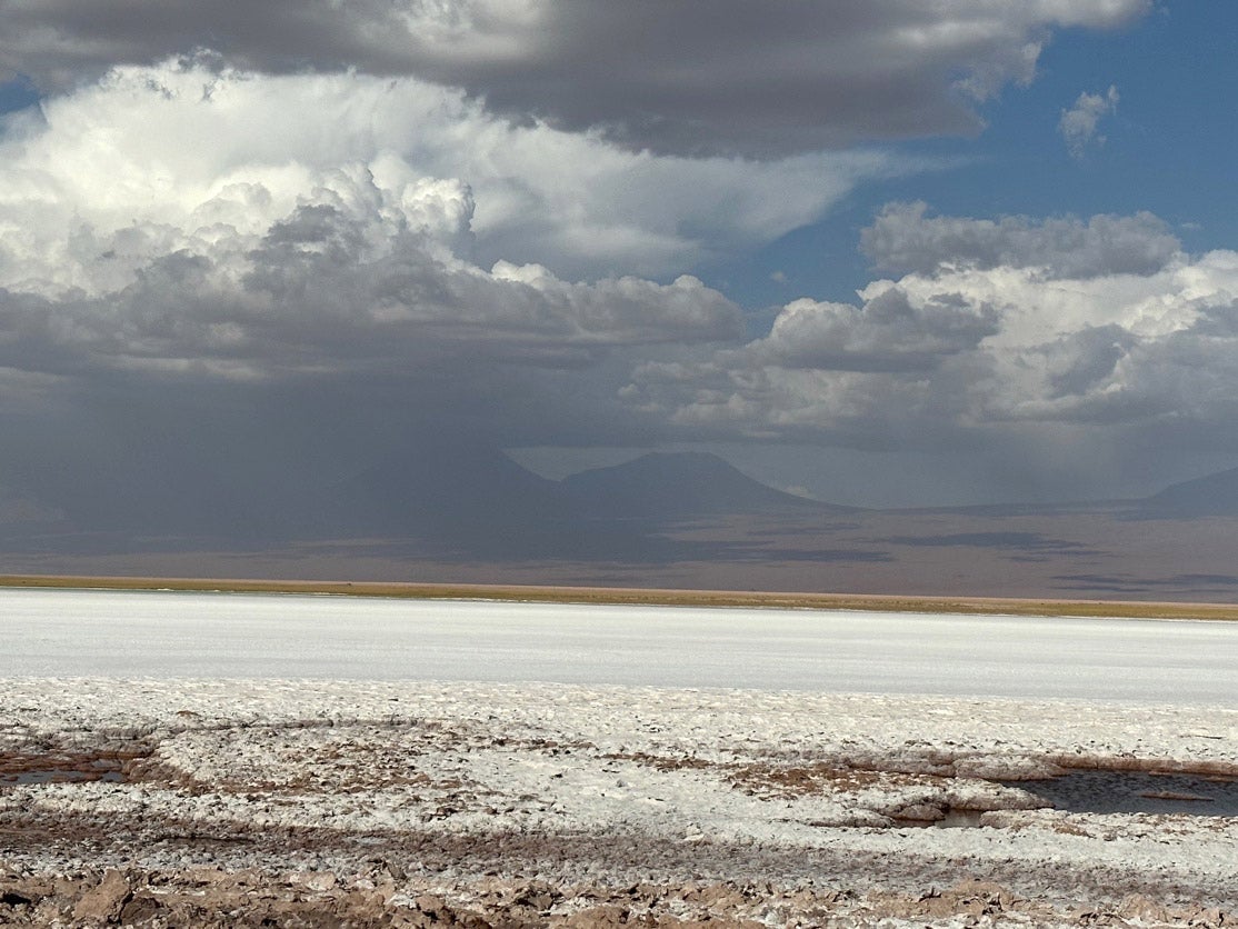
After a rest and lunch, and getting our bodies used to lower elevation, we prepared to go to the Salar de Atacama. It’s a depression that has underlying sedimentary materials that are salty. As the aquifer beneath solubilizes the materials, the water rises upwards with all the evaporation, leaving salt at the surface. It has no drainage and is between the main range of the Andes to the east, and a secondary range of the Andes called Cordillera de Domeyko to the west.
We noticed two striking things as soon as we arrived at the Salar de Atacama. First, it is a national preserve that is run by the local community. As Chile spends so little funding on its national parks and preserves, this is an interesting way to manage the infrastructure of preserves and provide income for the community.
Second, Salar de Atacama is one of the world’s largest lithium salt areas, and is aggressively mined. The mining process requires water, which is altering the landscape of the Salar de Atacama and depriving the locals, with greatly reduced water in the lagoons. This is one of the major controversies in the Atacama region at this time.
We had the opportunity to take a “swim” in the salty lagoon, which was more about lying on top of the dense water, floating in a crazy way! We called ourselves the “old salts.”
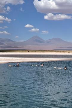
Floating in the Salar de Atacama. That’s me on the far right!

The water in this photo used to cover the entire foreground.
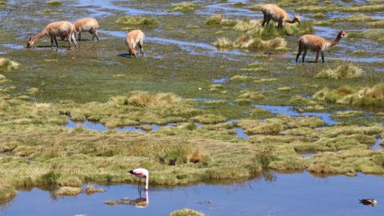
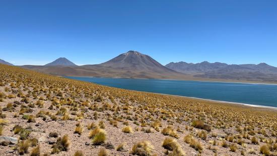
This was a great day! We went to Laguna Chaxas, in the Los Flamencos National Reserve, in the Central Andrean Atacama.
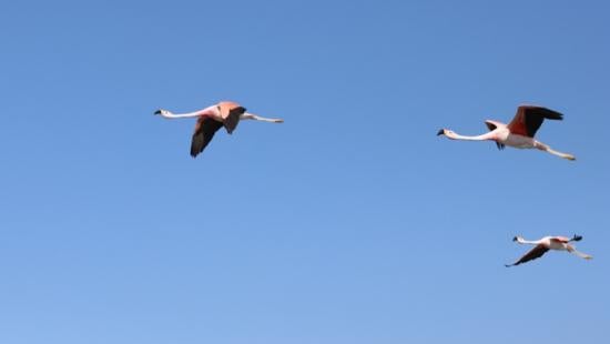
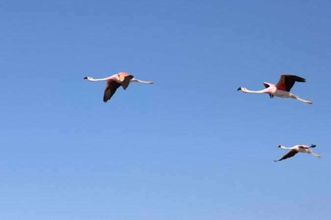
Flamingos in flight
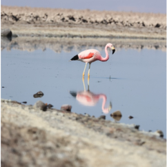
The Andean Flamingo (distinct black triangle at rear, orange on its beak)
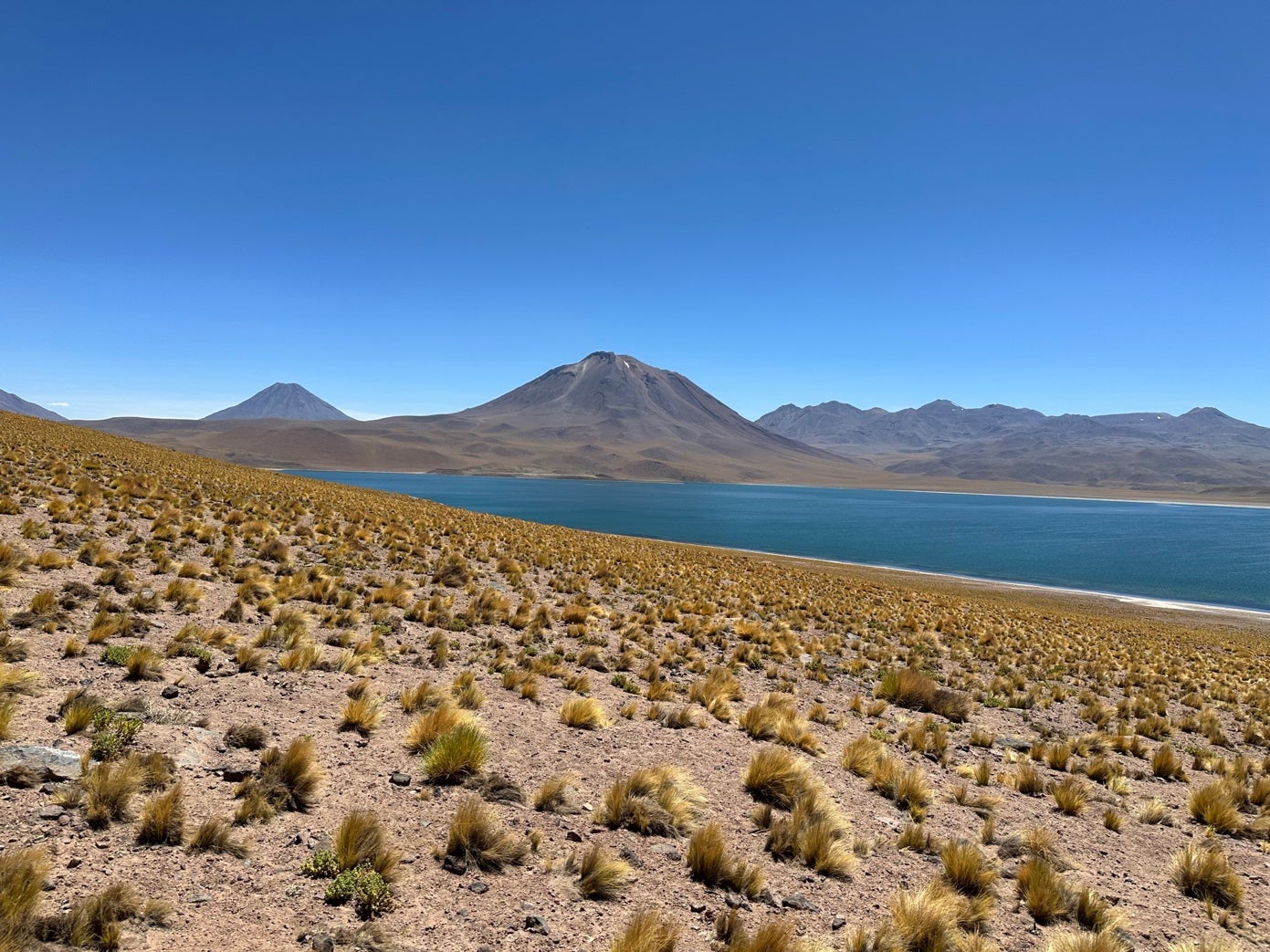
From here, we went up, up, up, to Laguna Miscanti, at very high elevation again, around 13,500 feet – the Chilean Altiplano, or Andes Plateau. The views were stunning, and we hiked down a ridge toward the Laguna, where vicuñas and flamingoes danced. The views of the high Andes were stunning. There was coirón in great abundance!
Vicuñas grazing
Plentiful coirón
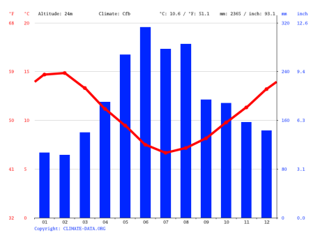
This day, we arose quite early to travel to Puerto Montt, then south to Puerto Varas. This is in the heart of the Lake District, Latitude of 41.5 degrees south (Puerto Montt – P. Varas is 41.3 degrees S). As you can see, it’s cooler than Santiago, and a bit wetter, with annual precipitation considerably higher than anywhere else we have been in Chile – 2365 mm (93 inches) a year! And only during November–March is there an average water deficit.
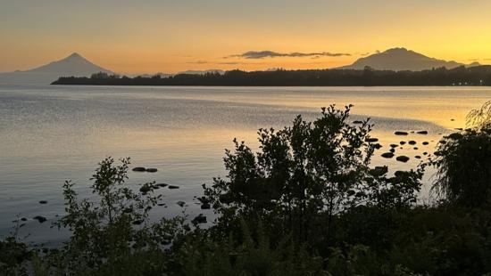
I arose early on the 26th for a run before our excursions. The view of Volcano Osorno (north, or left in the photo) and Volcano Calbuco (south and to the right), were wonderful over the largest lake in Chile, Lake Llanquihue.
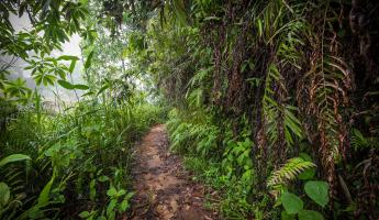
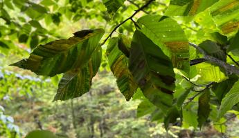
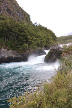
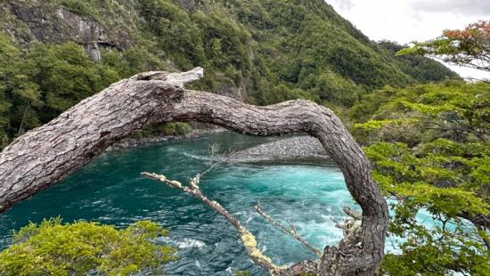
We traveled on to Vincente Perez Rosales National Park and hiked through the temperate rainforest of Nothofagus trees alongside a river, and saw some beautiful waterfalls. The Nothofagus genus is endemic to the southern hemisphere; many are evergreen. Plantations of exotic tree species, particularly Monterey pine (Pinus radiata) and Eucalyptus spp, have displaced many of the native forests in Chile, and this protected park is important for that reason. The Eucalyptus, once planted, is rather permanent as it is a root sprouter. The Eucalyptus, according to Carlos, is made into chips, sold to China, and then purchased back by Chile as paper.
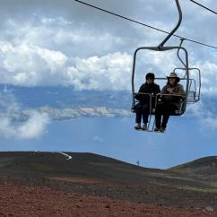
We then traveled to the Osorno Volcano, under pretty windy and cloudy conditions. It’s on the southeastern side of Llanquihue Lake, and still within the park. It has not erupted since 1869, and is home to a ski resort. We took the bus to the base of the ski lift, and split into groups, some of whom took the ski lift all the way to the top, near 8,000 feet elevation. It was reportedly QUITE cold on the way down. Others of us hiked up one pitch and took many photos on the way.
Synopsis of Indy’s lecture on Biodiversity Conservation in Chile: Challenges and Successes
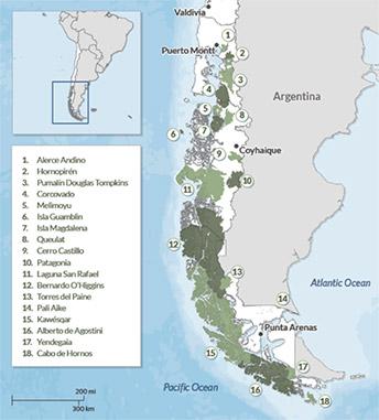
Chile is named by Conservation International and National Geographic Society as one of 36 international “biodiversity hotspots,” because it has more than 1,500 plant species found nowhere else on earth and because it has lost 70% of its original native ecosystems on land. The challenges for Chile, as for any country, are the tradeoffs between its natural resource economy and conservation. For Chile, the major uses of natural resources include mining, plantations for wood and pulp, and agriculture. Other threats to conservation include real estate development, climate change, and invasive species. (map above from Miranda et al. 2015)
The agricultural uses above require irrigation water, and rivers are being diverted to support the export economy. Salmon farming also has become a major part of the economy, with large impacts to water quality and quantity.
Still, Chile has had some successes in creating national parks (41), reserves (46) and national monuments (18), throughout the country. Government spending on these preserved areas is extremely low. Community investment in conservation occurs in isolated areas, such as the Saltar Atacama, and the Chiloe fishermen work in penguin conservation. International philanthropy has had a major role in conservation in Chile. There are recent successes in river and marine conservation, with 43% of Chile’s marine areas currently protected.
Vincente Perez Rosales National Park
Vincente Perez Rosales National Park
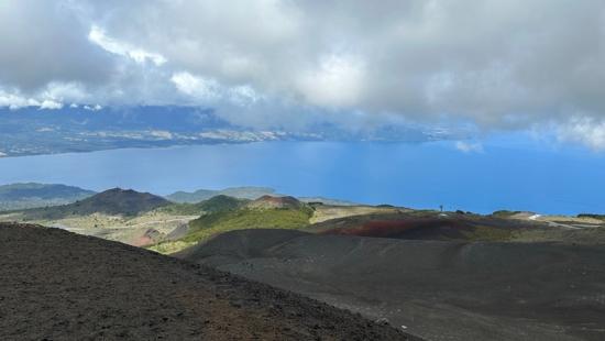
Lake Llanquihue from Osorno Volcano
Osorno Volcano
Chiloe Island, penguins, and more!
The following day, we sojourned to Chiloe Island (Chiloe means “place of seagulls”), the largest island in an archipelago by the same name, by bus, ferry, then bus again. It is about 41.5 degrees south latitude, again in the Lake District, and on the sea of course. There is high precipitation (over 2,000 mm) and 220 rainy days a year. Our guide Carlos explained to us during a bus tour that the island has a very special character, set somewhat apart from the rest of Chile, with 16 wooden churches designated as a UNESCO World Heritage Site for their unique architecture, and a strong farming and fishing culture. For decades, there has been a threat to the culture that a bridge would be built from the mainland, and while there are apparently very mixed opinions about this, it looks to be happening soon. An important part of the culture of Chiloe is “dominga,” or moving of houses seasonally, which is celebrated with special food and music. There is some fear that these unique traditions and characteristics could be lost with greater connectivity to the rest of Chile.
The strongest earthquake ever in the world occurred near Chiloe, the 1960 Valdivia Earthquake. It was a 9.5, and resulted in many people (~3,000) dying, and causing localized tsunamis. It rearranged the geography of the island. Our guide Carlos tells us that the people of Chile barely notice most earthquakes, and each Chilean will see at least three “major” earthquakes in their lives.
Today, Carlos tells us, 70% of the population of Chiloe is focused on the salmon industry, which is growing. Nearly everyone we met has deep concerns about the salmon industry and its environmental impacts in Chile, from growing an exotic species, to the high rate of antibiotic use, to the transportation pollution, to the salmon waste from feed and feces. Essentially, all the seaside of Chile is experiencing these issues.
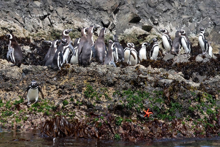
We set out to find the penguins! We learned from Carlos that Chiloe fishermen used to hunt penguins, but have now engaged in conservation and ecotourism, a more lucrative and sustainable way of living. Our fishermen guides had us step onto little trolleys that they pushed through the sand to boats, leaving us completely dry, then took us on a tour of four different penguin colonies.
There are two types of penguins here, Humboldt (50-75 cm), and Magellanic, shorter at 35-40 cm. The Humboldt penguin is endemic to the west coast of S. America, and the Magellan penguin also occurs in Tierra del Fuego and on the east coast. The Humboldts are threatened and I don’t think we saw them.
We saw many Magellanic penguins. Note the red around the eye, and not under the chin. These are making a racket, singing! Also see the starfish, below. We saw many other birds as well.
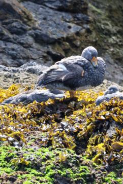
Flightless steamer duck
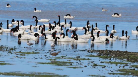
Black-necked swans
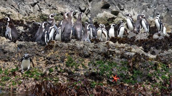
We saw many Magellanic penguins. Note the red around the eye, and not under the chin. These are making a racket, singing! Also see the starfish, below.
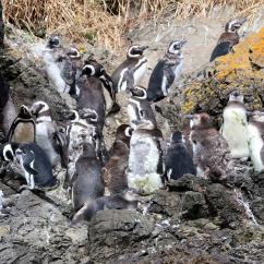
Juvenile Magellanic penguins, molting, with parents
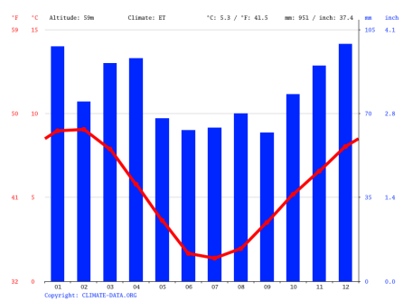
We wake up early, say goodbye to Carlos, and fly to Punta Arenas – now 53.2 degrees south latitude, another 2,200 km south, at the southern end of the Magellanes province of Chile. Notice that the average temperature is pretty chilly, and even in January the mean monthly temperature is under 15C/60 degrees F. There are no months that are technically experiencing a water deficit, because it is so cold, even though the average precipitation is only 951 mm.
The group had a short tour on the edge of the Magellan straits, and learned a bit about the history of the region. Before dinner, Professor Bill Lauenroth from the Yale School of the Environment gave a lecture about the megadrought that Chile is experiencing, similar to that of California, resulting in serious ecological and human consequences. The drought has lasted 18 years to date..
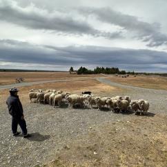
Our friend Pati Jarpa joined us for the lecture; she is a livestock veterinarian in Magallanes province who also manages ranches, and she tells us that many sheep ranchers are selling off their herds.
We meet our new guide, Val, and drove north and west 300 km, through rangelands grazed by sheep, by lakes that had dried up, past guanacos and rheas. We stopped at an estancia where we toured and where we were hosted to a delicious asada (barbecue of a lamb). The estancia was established by a Croatian family a century or more ago. We were shown sheep shearing and the estancia’s proud working dog herded sheep for us.
Even though this was a demonstration, it is clear that the sheep ranching, shearing, herding, and shepherding the landscape are very real parts of the lives of the estancia.
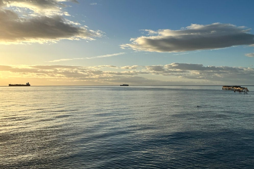
Sunrise over the Straits of Magellan
Dog herding sheep at the estancia
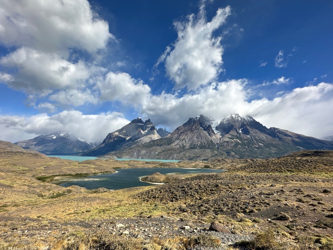
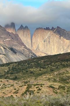
Then, we arrive at Torres del Paine National Park, and the Estancia Cerro Paine hotel at its edge! We had a wonderful dinner and found our beds with great anticipation for what the next day would bring.
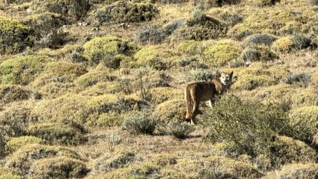
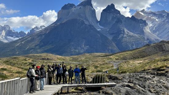
We awaken to a gorgeous, crisp day in Torres del Paine, and set off on a bus tour with Val, and have several hikes through the park. The landscape is stunning, and we learn a great deal from Val — she has terrific ecological and geological knowledge. She grew up in Punta Arenas and earned a degree in Ecotourism, a new field of study in Chile. We met a second guide, Daniel, also a recent Ecotourism graduate, who came with us as well. They told us before we left that we might see a puma, and one of our sharp-eyed companions saw one right away! Daniel helped us to get great photos through a spotting scope, so we didn’t disturb it by getting too close.
We ate lunch at a gorgeous spot in the park, complete of course with wine and cheese. Following this, we went to a glacial lake in the park, where we hiked in strong winds through the Notofagus forest to the lake at the head of the Grey Glacier.
This was a day of several excursions by choice, some on a long long hike, others horseback riding in the morning, and hiking or touring on the bus in the afternoon.
I began the day with another great run, with the goal of capturing better photos of the Torres (towers). We learned that the black cap is the sedimentary rock topping the magma that arose beneath a so-called “laccolith.”
We took a three-hour horseback ride, and it was stunning. The horses were terrific, and all the riders did a great job! (Ok, the mosquitoes were pretty ferocious, but it was lovely!)
In the afternoon, there were hikes, tours, and more.
We had a wonderful last dinner there at Torres del Paine, full of interesting conversations, and then prepared for a very early departure to Santiago the next morning.
Sunrise at Torres del Paine
We hiked in strong winds through the Notofagus forest to the lake at the head of the Grey Glacier.
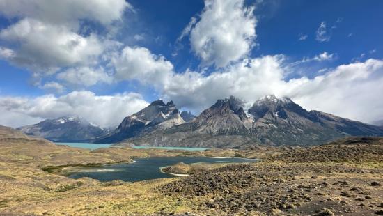
Another spectacular view in Torres del Paine
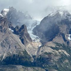
One of the many glaciers in Torres del Paine, all of which are retreating with climate change.
Biweekly, we highlight three news and research stories about the work we’re doing at Yale School of the Environment.
We leave very early for the long drive to Punta Arenas, then fly to Santiago, and have free time until dinner when we have our goodbye meal at a great restaurant. We meet a Yale Maurice R. Greenberg World Fellow for dinner, Alex Muñoz, who is a Chilean lawyer working now on marine preservation for National Geographic in Chile and throughout South America. Chile has protected 43% of its marine areas, which is a huge success. Alex has lectured for us in the Yale School of the Environment several times, and we are so happy to be associated with him! We all asked a lot of questions about the salmon industry, the damage it causes, and how we can responsibly eat salmon (the answer: not farmed salmon from Chile).
We have a free day to explore Santiago. Bill and I have lunch with two recent Chilean YSE alumni, who have much to tell us about how important their experience was in our School, and how much they’d like to help recruit more students from Chile to our school, and build a network of conservation and climate leaders there. We plan to follow up with them!
We had a bus trip to the airport and said airport goodbyes to our wonderful companions. So many thanks to the Yale Alumni Academy for an awesome trip!