This professor is accepting doctoral students

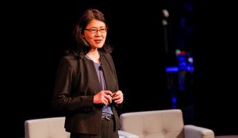
Karen C. Seto
Frederick C. Hixon Professor of Geography and Urbanization Science, Director of the Hixon Center for Urban Sustainability
More
Frederick C. Hixon Professor of Geography and Urbanization Science, Director of the Hixon Center for Urban Sustainability
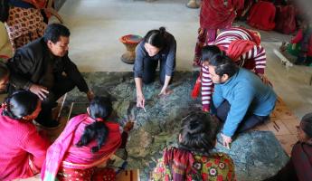
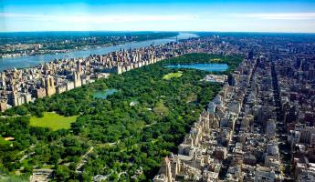
Karen Seto is the Frederick C. Hixon Professor of Geography and Urbanization Science at the Yale School of the Environment. She is one of the world's leading experts on urbanization and its impacts on the planet, including climate change, biodiversity, and food systems. A geographer and urban scientist, she integrates remote sensing, field interviews, and modeling methods to focus on four research themes: 1) measuring and characterizing urban land-use; 2) modeling and understanding the drivers of urban land-use change; 3) forecasting urban expansion; and 4) assessing the environmental consequences of urban expansion. She is an expert in satellite remote sensing analysis and has pioneered methods to reconstruct historical urban land-use. Her research developed the first forecasts of urban land expansion globally. She has extensive fieldwork experience in Asia, especially China and India, where she has conducted research for over 20 and 10 years, respectively.
Professor Seto serves on numerous national and international scientific bodies. She is chair of the Policy and Global Affairs Division of the U.S. National Academies and co-chair of the U.S. National Academies Climate Security Roundtable, established by the direction of Congress to help better understand and anticipate the ways climate change affects U.S. national security interests. She is also co-chair of the U.S. National Academies Subcommittee on U.S.-China Scientific Engagement. She was the Coordinating Lead Author for two UN climate change reports, the IPCC 5th (2014) and 6th (2022) Assessment Reports, where she co-led the chapters on how urban areas can mitigate climate change.
Professor Seto is committed to improving public understanding of an urbanizing planet. She was the Executive Producer of “10,000 Shovels: Rapid Urban Growth in China,” a documentary film that integrates satellite imagery, historical photographs, and contemporary film footage to highlight the urban changes occurring in China. Her book, City Unseen, co-authored with Meredith Reba (YSE MEM '14), uses satellite imagery to show how cities shape landscapes and how landscapes shape cities.
Professor Seto has received many awards for her scientific contributions, including the Outstanding Contributions to Remote Sensing Research Award from the American Association of Geographers. She is an elected member of the U.S. National Academy of Sciences, the American Academy of Arts and Sciences, and the Connecticut Academy of Science and Engineering. She is also a Foreign Academician of the Chinese Academy of Sciences, an elected lifetime member of the Council on Foreign Relations and a Fellow of the American Association for the Advancement of Science. She holds a PhD in Geography from Boston University.
This professor is accepting doctoral students
My research focuses on four broad themes: 1) Monitoring and measuring urbanization dynamics, including growth patterns and urban form; 2) Understanding the process of urbanization; 3) Assessing the environmental impacts of urban land-use change; and 4) Forecasting urban growth.
Monitoring and Measuring Urbanization Dynamics
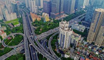
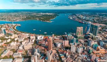
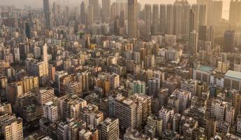
Imaging of Earth by NASA’s Landsat satellites over the past three decades has revolutionized how we monitor and map our planet. My research in this area focuses on understanding and characterizing urban land-use change patterns. How are urban areas changing? What landscapes are being lost to urban expansion? How do the rates and magnitudes of urban land-use change vary across time and space?
Understanding the Process of Urbanization
Urban land-use change is a function of complex interactions among multiple drivers, ranging from local policies to international capital flows. My research focuses on understanding the causes behind urban expansion. What drives urban land-use change and urban form? How do these factors interact and what are their relative and collective importance in causing urban development? Why do we see similar patterns of urban land-use change across regions and cultures?
Evaluating the Environmental Impacts of Urban Growth
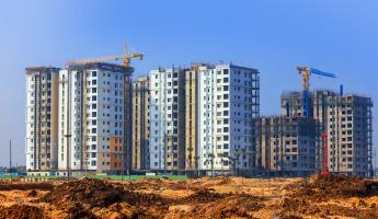
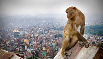
As urban areas expand, they impact the environment across all scales, from the local to the global. In many areas, urban expansion occurs at the expense of fertile agricultural land. In other regions, urban development envelops wildlife habitat. Everywhere, urban land-use change modifies the interaction between the land surface and atmosphere. How does urban land-use change affect the demand for energy and other natural resources? What are the implications of a rapidly urbanizing Earth for land conservation and biodiversity?
Forecasting Urban Growth
By 2050, the world urban population is expected reach 6.5 billion. Where is urban land-use change likely to occur in the future? How will the global configuration of urban settlements change in the next forty years? Because every aspect of urban land-use has significant environmental implications, forecasting scenarios and patterns of urban land-use change will be critical for the conservation of energy resources, the preservation of agricultural land, and ultimately, environmental sustainability.
I want to train the next generation of geographers and urban scientists. Just as the invention of the microscope provided a new lens to view science, modern geographic tools such as remote sensing, big data, and spatial analysis provide a fresh perspective on the world, urban areas, and the relationship between urbanization and the environment.
My teaching philosophy rests on three tenets: integrating students in research, developing writing skills, and fostering critical systems thinking. My approach to education mirrors my research: I emphasize interdisciplinary training that is hands-on and cutting-edge. I find mentoring and teaching students fulfilling because it offers an opportunity for me to engage and collaborate with the next generation of scholars and leaders.
I offer a range of classes, from technical courses on urban remote sensing and digital image processing to seminars on urban mitigation of climate change.
B.A. University of California, Santa Barbara;
M.A., Ph.D. Boston University