Note: Yale School of the Environment (YSE) was formerly known as the Yale School of Forestry & Environmental Studies (F&ES). News articles and events posted prior to July 1, 2020 refer to the School's name at that time.
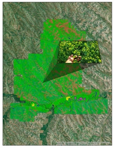 Using satellite imagery embedded with data on reflectance, the UHPSI team will work on developing statistical tools that rapidly scan a large area to locate plants or land-cover of particular interest. In northeastern Wyoming, the team will be using the tools to locate leafy spurge (<em>Euphorbia esula</em>; displayed within the inset image above), an invasive species that displaces native rangeland vegetation.
In support of their ongoing land stewardship studies in Wyoming, a team of Yale researchers has received a “Google Earth Engine Research Award.” The award will help the Ucross High Plains Stewardship Initiative make advanced methods for rapid land-cover detection and assessment available to the public through the use of freely available satellite data.
Specifically, they will work to integrate various statistical methods into Google’s new Earth Engine platform as preset tools that will allow users to evaluate vegetation or land-cover types of interest for any area of the globe.
These preset tools will be available to anyone in the world with an Internet connection and a Google account.
The Ucross High Plains Stewardship Initiative is a partnership between the Yale School of Forestry & Environmental Studies (F&ES) and the Ucross Foundation, and is directed by F&ES professor Chadwick Oliver.
Their research will incorporate contemporary methods for remote sensing, coding, and multivariate statistical analysis. The team expects to release its work at the end of 2014.
The Ucross Foundation is located on a 20,000-acre working cattle ranch in Clearmont, Wyoming.
Published
January 30, 2014