Note: Yale School of the Environment (YSE) was formerly known as the Yale School of Forestry & Environmental Studies (F&ES). News articles and events posted prior to July 1, 2020 refer to the School's name at that time.
An interdisciplinary collaboration between two professors from the Yale School of Forestry & Environmental Studies that aims to define the “value” of satellite-based earth observations has received a $100,000 award from Resources for the Future (RFF).
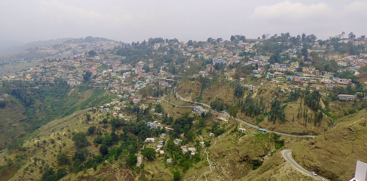
The project, conceived by Professors Eli Fenichel, an associate professor of ecosystem management and bioeconomics, and Karen Seto, a professor of geography and urbanization science, will estimate the value of satellite data being used to measure and map the urbanization of the mountainous Hindu Kush Himalayan region.
The team will work with VALUABLES Consortium, a cooperative between RFF and NASA, to quantify and communicate the socioeconomic benefits of earth observations.
The proposal grew out of an ongoing research project, led by Seto, which uses satellite imagery to examine the links between urban growth, disasters and vulnerability in towns of the Himalayan region. Prompted by a 2015 earthquake that devastated parts of Nepal, triggering thousands of landslides that buried whole villages in mud and rock, the research is producing information to offer clarity on the region’s changing urban settlements.
The Yale research will assess the value of remote sensing products for allocating resources when administering disaster relief in places like the Himalayan region — and throughout the world.
“If decision-makers had the information from Karen’s research at their fingertips after the earthquakes hit, what could have been done differently? And how can we parse that information?” said Fenichel, the new project’s principal investigator. “That’s the real value of information and science — and one that is of first order importance to policy-makers.”
The benefits of remote sensing technology is particularly relevant in places like the Hindu Kush Himalayan region, Seto said. The region, which is home to more than 210 million, is situated at the nexus of two destabilizing trends facing mountainous regions worldwide: an increase in natural disasters and a surge in urban development.
Her satellite-based research in the region, which is funded by NASA, is revealing just how much the region continues to change as urban development alters the landscape in a region that is already vulnerable to threats such as earthquakes, landslides, fires, and floods.
“In 2015 we had this tragedy where if we knew where people were located we might have been able to save more lives,” she said. “What we’d like to do is use the information we’re able to collect through remote sensing to better understand where people are building and where roads are located, to better estimate just how reachable they would be in a disaster, whether there are passable roads, and how long it would take to reach them.
“There you would see a very real value to remote sensing data.”
Resources for the Future (RFF) is a Washington, D.C.-based nonprofit research organization that seeks to promote better environmental, energy, and natural resources decisions through impartial economic research and policy engagement.
The award, created in honor of Molly Macauley, RFF’s former vice president for research, supports research that quantifies the socioeconomic impacts of earth observations applied in the pursuit of solving pressing societal challenges.
– Kevin Dennehy kevin.dennehy@yale.edu 203 436-4842
Published
July 25, 2018